Total Items: 0
Sub Total: $0.00
The Garmin inReach is a dedicated SOS and satellite communication device. In recent models, Apple has given users the ability to make SOS calls via satellite. With the release of iOS 18, users can now send messages via satellite as well. So that begs the question, in 2024, is it still worth owning one a Garmin inReach when you probably already own an iPhone?
Now, we're all familiar with the features that our smartphones offer—from maps to music, social media to pictures, and now satellite communication is another string to the smartphone's bow. However, I think there is still a call for dedicated devices. For example, there's a reason why I don't track my runs or longer hikes on my phone and use a sport watch instead. I'd say that this case isn't any different. So is the smartphone in danger of becoming a jack of all trades while being a master of none?

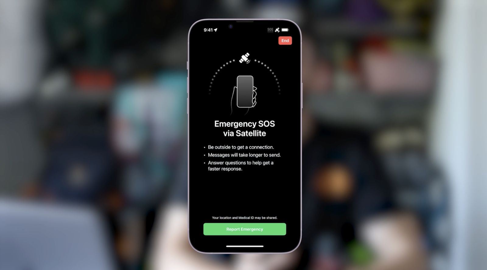
If you try to call Emergency Services via your iPhone and there isn't any Wi-Fi or cellular service, your iPhone will prompt you to connect via satellite. The process of connecting to satellite is, as most think, typically Apple—pretty intuitive. An onscreen graphic will guide you through the process and show you which direction is best to point your phone in. However, before you go off-grid, you're going to want to set up your emergency contacts as well as your medical ID because these can be shared with emergency responders. If you are unable to call Emergency Services, you can now text them via satellite on the iPhone. Again, that process is relatively straightforward, and the phone will walk you through it, asking you a series of questions. It will also ask you if you want to inform your emergency contacts of your situation.
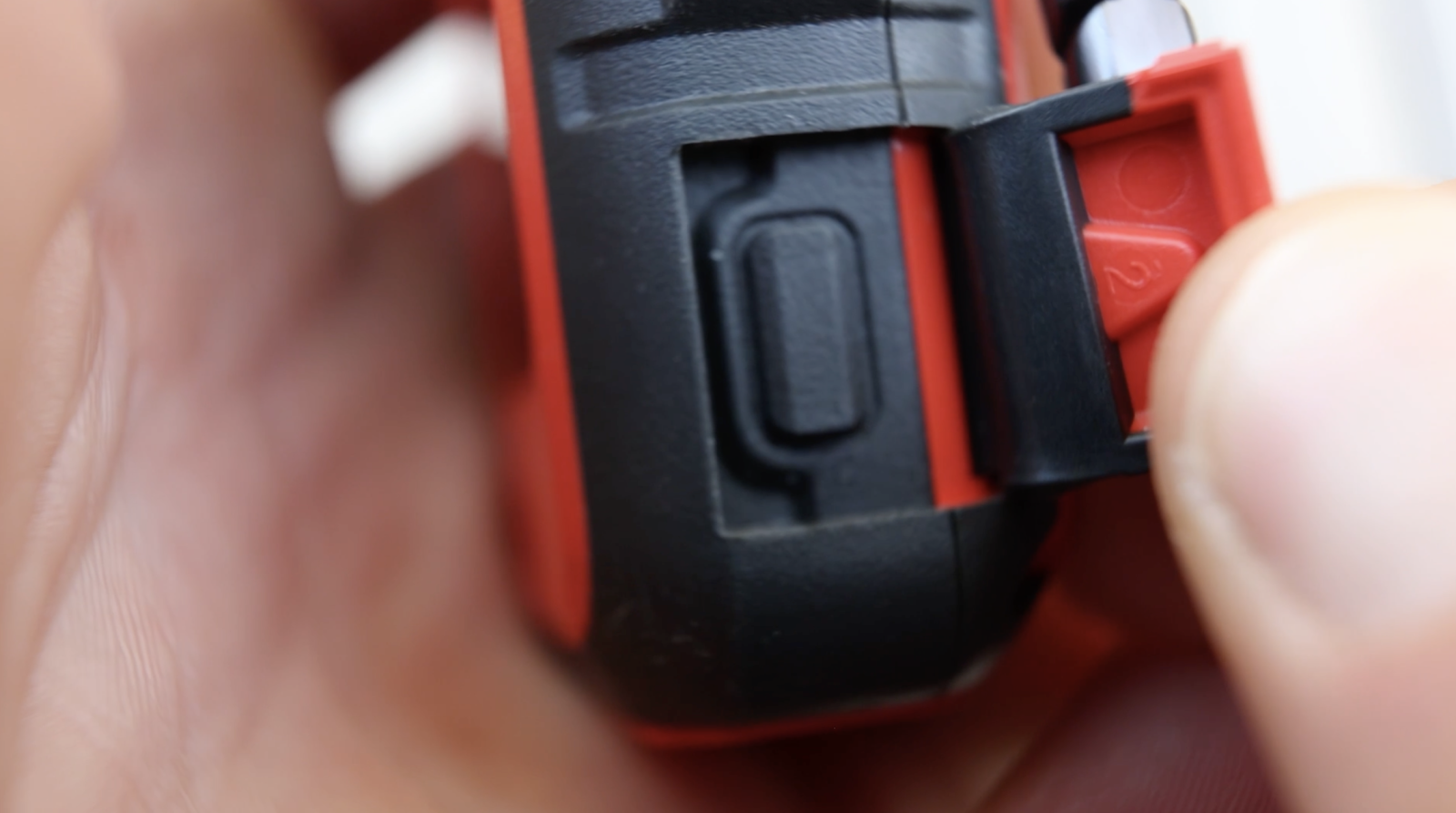
Garmin is a little different. It actually has a worldwide 24/7 response team, and to trigger an SOS on a Garmin inReach, the SOS button is just behind a small flap. That button needs to be held for a few seconds to activate an SOS. One advantage of that being so simple and easy to find is that, say, if a passerby needed to activate it, they could do so with very little experience—even if you are unconscious.

When you trigger an SOS on a Garmin inReach device, the Garmin International Emergency Response Coordination Center (the ICC) receives an alert. This team will immediately use your longitude and latitude to determine your location and identify the best agency to initiate the rescue. This could be a more typical emergency response like an ambulance or fire service, or it could be a specialised team like Mountain Search and Rescue or the Coast Guard. The ICC agent will be able to communicate with you via your inReach device, as well as call any of your emergency contacts set up in your profile to gather more information. This team will still send updates to your device and initiate a rescue, even if no response is given. When SOS is active, an updated location is sent every minute for the first 10 minutes, and after that, an updated location is sent every 10 minutes to conserve battery.
To be honest, it’s a little difficult to tell 100% how Apple’s SOS function would play out in real life. An article in *Mountain Life Magazine* describes a rescue of two climbers in British Columbia, Canada. In this article, they mention how Apple was apparently not allowed to contact search and rescue directly. That responsibility fell upon their emergency contact. After asking Apple to contact search and rescue, they received a relatively generic message that read, "The appropriate emergency services have been contacted, and an ambulance is on its way." But these climbers were six hours hiking from the road, so an ambulance wasn't going to be much help. Around 10 hours after the initial SOS call, a helicopter did show up. It turns out that their emergency contact had coordinated with the local search and rescue to get the rescue underway. Apple staff later mentioned to the climbers that their emergency contact would have received those messages earlier if they were using an iPhone, but the emergency contact had an Android.
Now, that article was from the start of the year, and I know Apple is striving to make a lot of improvements and investing money into their SOS system. However, in this more remote, extreme example, I think a Garmin inReach would have been the better choice and done the job quicker. But, of course, it was better than nothing, and the device you have on you is always the best one at the time.
Two-way messaging is available during SOS calls on both systems, so you can communicate with your dispatcher. However, two-way messaging outside of that used to be a feature only available to Garmin inReach. With the upcoming updates in iOS 18, two-way messaging via satellite to friends and family is coming to the iPhone as well. Once connected to satellite, messaging on the iPhone looks the same as usual—use the messaging app to send messages, receive messages, send emojis, and even tapbacks just like you normally would. With the inReach, you can also send two-way messages in non-emergency situations, either in the form of check-in messages, pre-written templates, or completely custom messages. These can be sent directly on the device itself or by using the app. It’s easier with the app, but for that, you need a phone. It’s still great to be able to send, receive, and write messages directly on the device itself because, inevitably, your phone will probably run out of battery at some point.
With check-ins and messages on the inReach, it will automatically share your location with the recipient. This is the case if sent directly to another inReach device, via the Garmin Messenger app, SMS, or a link sent via email. Anyone who clicks those links will be shown a map of your exact location at the time the message was sent.
For me, that is a valuable feature because if my partner goes on a trip and sends me a message saying she's starting her hike, I know exactly where her car is parked. Or if she checks in in the evening and says, “We just got to camp,” again, I know exactly where that is.
Initially, the satellite messaging function for the iPhone is only being rolled out in the US but will expand in the future. There are still a few questions with that system, like will it work in every country, or will it work on every carrier? This is still early days for Apple, whereas Garmin has been in this space for decades.
Now, this is probably a good time to mention cost. With the Garmin inReach, there are several subscription options which you can check out here. All of them include unlimited check-ins with that location data attached, but there are different quantities of messages and tracking options depending on which plan you choose. Each message you send or receive counts towards that allowance, and anything outside of that is charged extra. You can also choose to pay for a month here and there and pause the subscription when you don’t need it. Bear in mind you also need an active subscription for the SOS function to work.
As for Apple's version of the SOS function, it’s currently free for the first two years from the activation of your iPhone 14 or 15, but after that, it’s unclear if it will cost anything. There's no pricing on satellite messaging yet either, which you might use to contact friends and family when in remote areas.
On the iPhone, you can share your location using the Find My app, which is similar to how you’d use it to find your phone or earphones. However, Garmin wins this one for me. On top of receiving location data with each message via the Garmin inReach, you can leave a breadcrumb trail with different frequencies, starting as regularly as every two minutes. This feature allows someone else to monitor your trip, and if they see you haven't moved for hours, they can send search and rescue to your location without you having to trigger the SOS button. This could be life-saving.
The Garmin inReach can also mark waypoints and track back to your start point, waypoints, or the last message you sent, which is helpful if you get lost. You can do this directly on the device or use the Garmin Explore app to access detailed topo maps.
As for connectivity, the iPhone uses the Globalstar Satellite Communication System, while the inReach uses the Iridium network. Globalstar has a reputation for being less accurate, whereas the Iridium network has more satellites in orbit and a higher number of satellites paired with a beefier omnidirectional antenna, giving the Garmin inReach better coverage. Both devices need a clear view of the sky to get good signal. The Garmin inReach is designed to be clipped onto the outside of a pack, while phones are usually kept in your pocket, which can affect the signal.
According to Apple's website, SOS satellite communication on the iPhone is available in certain countries—Australia, New Zealand, parts of Europe, Japan, and the US, about 18 countries in total. Garmin inReach, on the other hand, works globally, with a few exceptions.
Garmin inReach has 14 days of battery life using 10-minute tracking and up to 30 days with 30-minute tracking. In comparison, you'd be lucky to get a full day out of an iPhone, especially if you're using it for pictures, music, or mapping apps. You could take a battery pack, but I prefer to leave my phone for pictures and music and not worry about my SOS device running out of battery.
Another useful feature of the inReach is that you can request weather forecasts, which cost the same as sending a message. The device is rugged, water-resistant, and designed for harsh conditions. It will survive multiple drops, unlike most phones, which have some water resistance but aren't designed to be left out in the elements all day.
In conclusion, the iPhone's new satellite communication features are fantastic and will save lives. But for longer, more remote trips, it doesn't replace a dedicated device that provides peace of mind, longer battery life, better connectivity, more precise location services, and worldwide coverage.
Not sure what gear you need for your adventure? Chat with our friendly team of Outdoor Gear Specialists in-store or online today and don’t forget to share your adventures with us on Instagram by tagging @wildearthaustralia and #mywildearth in your next post.
About the contributor:
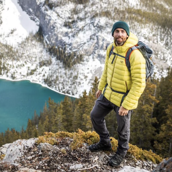
 Simon Ennals is a Wild Earth ambassador, landscape photographer and outdoor enthusiast. Whether it's trail running, climbing or hiking you'll find Simon outdoors testing gear and exploring the Canadian Rockies where he resides. Follow his adventures on Instagram (@simonennals)